The information in this article applies to:

QUESTION
In a floor plan view, I have created a plot plan polyline using the CAD tools. I would now like to convert this polyline into a terrain perimeter. How do I do this?
ANSWER
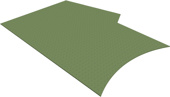
Chief Architect allows you to convert 2D CAD drawings into a variety of 3D objects, including a plan's terrain perimeter. This allows you to create a terrain perimeter that both bounds the 3D terrain and defines the property on which the plan will be built.
To convert a polyline into a terrain perimeter
- Access the plan that contains a plot plan polyline.

- Using the Select Objects
 tool, click on the plot plan polyline to select it, then click the Convert Polyline
  edit button.
- In the Convert Polyline dialog that displays, select the Terrain Perimeter option, then click OK.
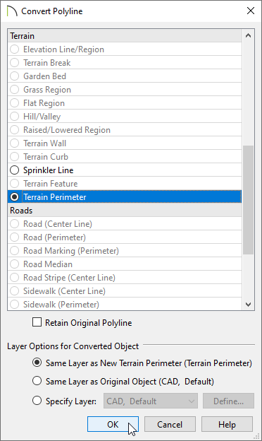
- In the Terrain Specification dialog that appears next, make any desired changes to the specifications for your terrain, then click OK.
- Your terrain perimeter is now visible in both 2D and 3D views. To view the results in 3D, select 3D> Create Perspective View> Perspective Full Overview
 .
.